![Item #11281 Itinerarivm prouinciarum omniu[m] Antonini Augusti. Itinerarium Antonini.](https://mckittrickrarebooks.cdn.bibliopolis.com/pictures/11281.jpg?width=768&height=1000&fit=bounds&auto=webp&v=1661454041)
![Itinerarivm prouinciarum omniu[m] Antonini Augusti.](https://mckittrickrarebooks.cdn.bibliopolis.com/pictures/11281_2.jpg?auto=webp&v=1649770934)
![Itinerarivm prouinciarum omniu[m] Antonini Augusti.](https://mckittrickrarebooks.cdn.bibliopolis.com/pictures/11281_3.jpg?auto=webp&v=1649770934)
![Itinerarivm prouinciarum omniu[m] Antonini Augusti.](https://mckittrickrarebooks.cdn.bibliopolis.com/pictures/11281_4.jpg?auto=webp&v=1649770934)
![Itinerarivm prouinciarum omniu[m] Antonini Augusti.](https://mckittrickrarebooks.cdn.bibliopolis.com/pictures/11281_5.jpg?auto=webp&v=1649770934)
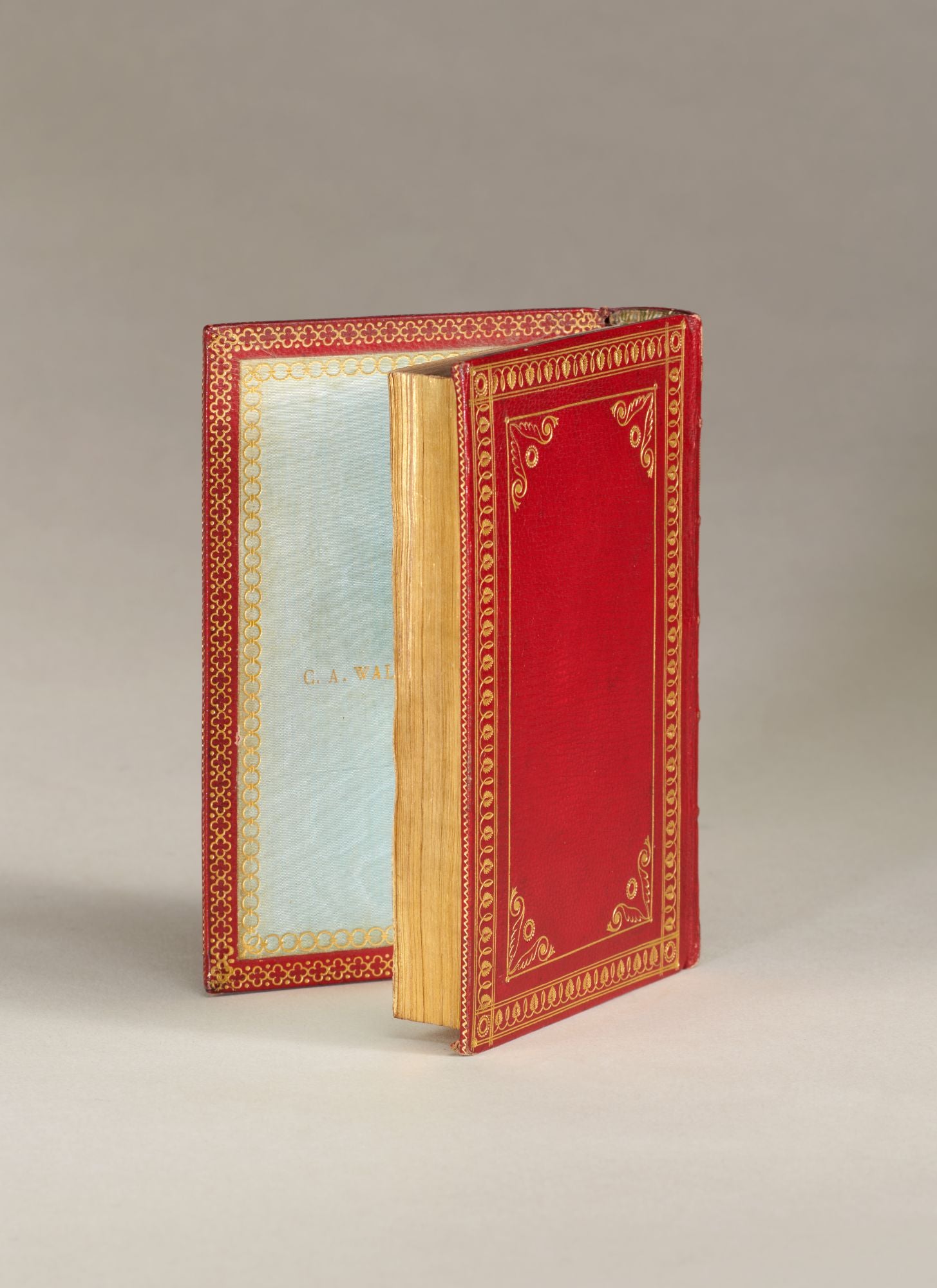
Itinerarivm prouinciarum omniu[m] Antonini Augusti.
Paris, H. I Estienne [1512].
16mo (120 x 75 mm.). [vii], [i blank], 92, [60] leaves. PRINTED IN RED AND BLACK THROUGHOUT. Roman type, floriated white-line metalcut initials, GEOFFROY TORY’S WOODCUT CIVIS device at the end.
Richly gilt red morocco (Simier; rubbed), dots, fronds, foliage and lettering on the spine, gilt turn-ins, blue watered silk pastedowns and free endleaves (one gilt-lettered C.A. WALCKENAER), all edges gilt.
EDITIO PRINCEPS. “REMARKABLE FOR THE BEAUTY OF ITS EXECUTION” (Bernard) and “the tiniest production of Henri Estienne’s press” (Schreiber), the Antonine Itinerary is the most important guidebook from classical antiquity, listing over two hundred land routes of the Roman Empire c. 300 C.E. and covering c. 53,000 miles — from Samsat to Mauritania and Hadrian’s Wall to Aswan. Each route comprises a list of the cities along the way and the distances between them. A section at the end gives sea routes.
Contemporary soldiers, diplomats, pilgrims, traders, scoundrels and refugees consulted it for travel, medieval cartographers for maps and modern scholars to study networks. TORY EDITED THE TEXT from a manuscript of Christophe de Longueil (1480-1522). A fine copy, canceled early signatures of Angelus Maria ?Bonati (with a few annotations), Franciscus Fogaroli and Antonius Maria Rossenius (Lyon); from the libraries of C.A. Walckenaer (1771-1852), Ambroise Firmin-Didot (Catalogue (1878) 659) and Thos. Brooke (1830-1908,).
¶Bernard, Tory 5-6; Schreiber, The Estiennes 15; De Beer, “The Development of the Guide-Book” in Journal of the British Archaeological Association S. 3 v. 15 (1952) 37; Maas & Ruths, “Road Connectivity and the Structure of Ancient Empires” in Highways…and Road Systems in the Pre-Modern World edd. Alcock et al. 255-64; Mortimer, French 326 (with a woodcut map known in one or two other examples).
Price: $17,000.00